|
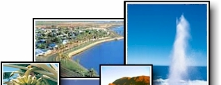
Carnarvon's unique location, just
south of the tropic of Capricorn, makes it the
perfect tropical oasis. Situated approximately
904km north of Perth, Carnarvon is a
place to relax and enjoy the sunshine or take a
break before continuing your exploration of
Western Australia.
Carnarvon's wonderful climate and
beautiful beaches stretch north towards the
Ningaloo Reef and south towards Shark
Bay. With its abundance of
attractions, a host of
accommodations and exciting tourism
products the town is a wonderful place for a
truly memorial holiday.
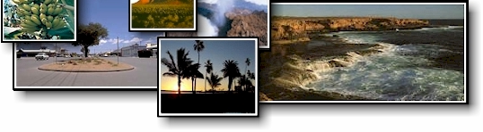
Carnarvon is
commonly recognised for its banana
plantations, tropical fruits,
fine seafood and warm climate and
situated in the heart of the Gascoyne
Region on the doorstep of the Indian
Ocean.
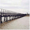
Also known as a
fisherman�s paradise, Carnarvon has many
prized fishing spots, the most famous of which
is the one-mile jetty. Carnarvon
is also well known for great surfing and
its tropical mango and banana plantations.
Inland from
Carnarvon is a very different landscape.
To the east, 450 kilometres away is Mt
Augustus, rising 1,160m above sea level.
Mt Augustus is twice the size of Ayers
Rock. The Kennedy Ranges are 160
kilometres from Carnarvon and offers an
opportunity to explore for fossils and gem
quality stones, not to mention the natural
beauty of the ranges.
Carnarvon
provides excellent accommodation
including Bed & Breakfast,
self contained, resort, hotel motel &
caravan park
accommodation.
|